Moretrench Industrial offers a wide range of state-of-the-art terrestrial, aerial, and water-related mapping and surveying services that deliver rapid and extremely accurate results in hours/days rather than the weeks typically required for traditional techniques. All operations are conducted remotely, meaning 100% personnel safety.

Common uses
Overview
The Southeast’s major industrial plants include power, mining, and chemical and manufacturing. These plants have several things in common: the facilities are large and can be spread over a wide area; they have strict access and movement protocols; any unplanned disruption to full operational status is critical and must be resolved quickly and effectively so the impact to their clients is minimized; and they demand the highest safety standards. This is where Moretrench Industrial’s dedicated tech solutions department comes into its own.
All of the services we offer can be conducted remotely. They can be completed in days, sometimes hours, expediting any required planning or remediation work. They offer a quick, safe, and more comprehensive level of data acquisition with our 3D scanner able to gather 50,000 points/sec, and both the scanner and mapper can produce dense point clouds with point spacings in inches rather than the feet found in a traditional survey. A custom-made mobile van with an onboard generator, office, and equipment points for live broadcasts on large display screens supports operations. This allows us to undertake any data-gathering operation and support, view, and process data on the spot. All of this adds up to a value-engineered approach that can detect small issues before they become big ones.
Our systems are available as an integral part of a contract with an existing client or as a stand-alone service for future planning to determine the viability of a proposed project approach.
We have invested heavily in these services that have significantly enhanced our ability to provide the highest level of performance for our clients’ existing contracts which translates to the highest possible level of service at no additional cost.
Highly efficient and precise UAV (unmanned aerial video) topographical surveying utilizing a 42-megapixel camera with on-board positioning that can cover very large areas (500+ acres) in a matter of hours. The system utilizes photogrammetry to provide a 3-D surface that meets survey tolerances. Post-processing of data can be accomplished on the same day. Submittals include colored 3-D cloud points, 3-D surfaces, aerial maps, and 3-D point contour data for volumetric and production reporting.
This system supersedes our original ground-based terrestrial 3D laser scanner, which is now utilized for all indoor and highly detailed scans for such work as retrofitting existing structures, materials testing, and structural as-builts.
We have also introduced a cutting-edge confined space UAV for indoor inspection of small, hard-to-reach, and hazardous areas and allows for live video of any confined space area greater than 30 inches. The unit is collision-resistant, features onboard GPS-free stabilization, and can inspect surfaces such as welds using a distance lock.
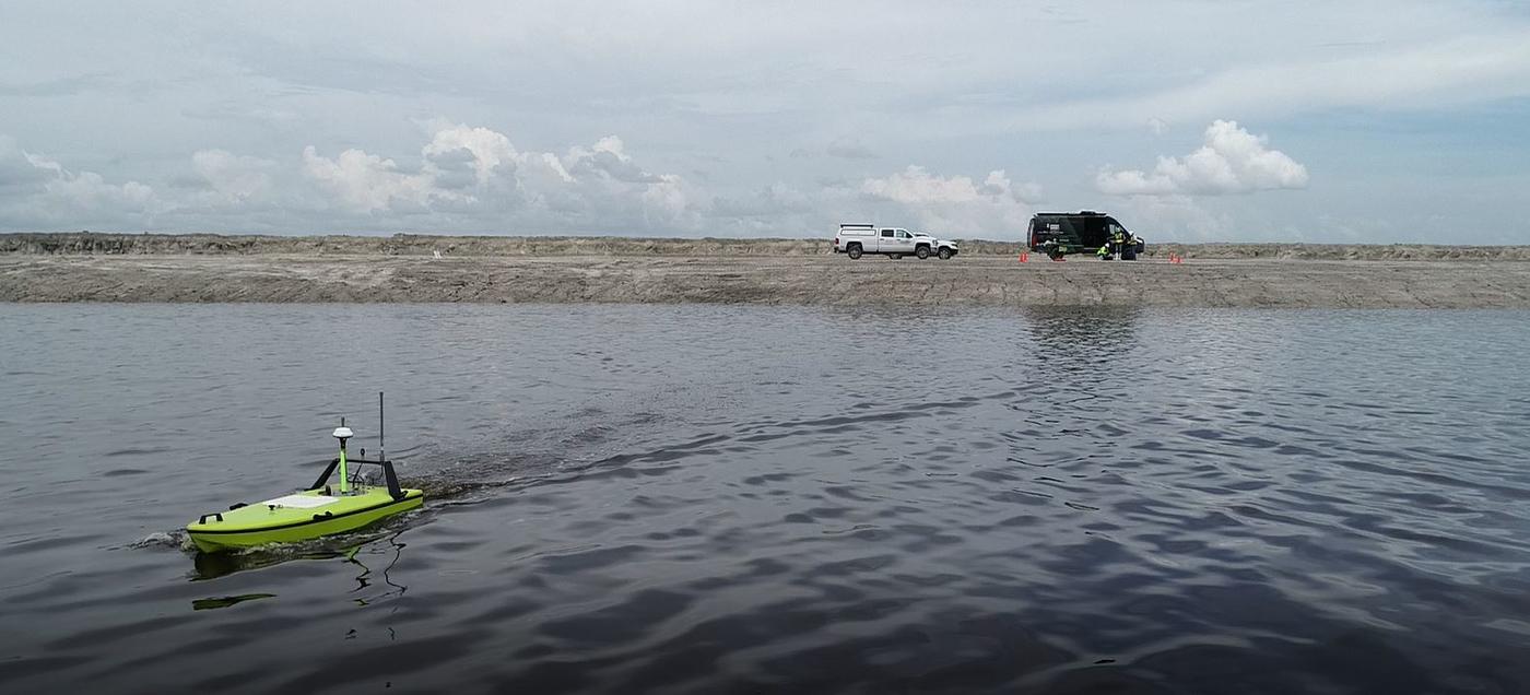
Over-water and underwater work is inherently risky, particularly in the corrosive environments found on industrial sites. We eliminate the potential for personnel injury by utilizing remotely controlled systems that ensure operators are always land-based. Underwater bathymetric surveys are conducted by a small, remote-controlled survey boat capable of measuring depth and mapping underwater features of pond bottoms and waterways. The system uses onboard GNSS positioning and a dual-frequency echo sounder for precise data acquisition.
We also use an underwater inspection and survey drone with a depth and distance rating of 656 ft. The operator can view footage from its live onboard camera onshore via an industrial-grade tether cable. The drone also features a grabber arm to allow small item/sample retrieval.
We also carry unmanned aerial systems for aerial photography and videography, as well as time-lapse construction cameras, weather stations, RFID asset tracking, and a push camera system for pipe and well inspections.
